


Met Office: Amber snow warning for the north with the weekend set to bring high winds
Register for free to read more of the latest local news. It's easy and will only take a moment.

An Amber warning has been issued for northern parts of Scotland as winter hazards continue to dominate the weather.
Cold Arctic air remains dominant over the UK, with snow and ice likely to continue ahead of the weekend for many in the northern half of the country, including Scotland, Northern Ireland, parts of north-west and south-west England, and north and west Wales.
A number of Met Office weather warnings are in force on Wednesday and Thursday.
An Amber warning for snow has been issued for northern parts of Scotland, where high ground could see in excess of 40cm of snow accumulate before the weekend.
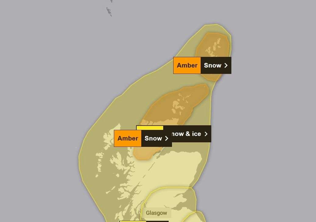
Lower ground in the north of Scotland is more likely to see 5-10cm of lying snow accumulate ahead of the weekend and a Yellow warning remains in place.
Met Office Chief Meteorologist Jason Kelly said: “With deep snow already lying on the ground for many in the northern half of the UK, we’re going to see a significant topping up of totals over the next couple of days, especially for those in the north of Scotland.
“Within the Amber warning area, an additional 15-20cm of snow is possible in a few locations. Strengthening northwesterly winds will also cause some lying snow to drift, potentially bringing some additional hazards, such as temporary blizzard conditions.”
The cold Arctic air currently in place over the UK will start to be displaced from the south from Friday, with a return to milder Atlantic air from the west.
However, while temperatures will increase from the markedly low figures of recent days, this change in airmass will also introduce the likelihood of a return to wet and windy weather for most through the weekend.
On Sunday a Yellow Warning has been issued for the whole of the day covering the north again as a period of strong winds and persistent rainfall is expected.
Whilst there is still some uncertainty as to the exact locations which will see the strongest winds, northern and western areas are likely to be most at risk.
Many inland areas are expected to see gusts of 50 - 60 mph during this period. Coasts and exposed locations could see gusts of 60 - 70 mph or even higher
Met Office Deputy Chief Meteorologist Dan Rudman explained: “While the next few days will remain cold, we can see a change in weather type on the way, bringing milder air for the UK and returning temperatures to around average for the time of year from Friday onwards and well above average into next week.
“This change will initially be relatively benign in terms of weather impacts, with a dry Friday and start to Saturday for many in the south of the UK.
"The Atlantic influence will then introduce some wet and windy weather, with a deep area of low pressure approaching from the west on Sunday. "While detail is still being worked out, this has the potential to bring heavy rain and strong winds for some, and we’ve issued an early warning for a large part of the UK.”