


Is it a bird? Is it a plane? RAF Lossiemouth trials radar system to avoid bird strikes
Register for free to read more of the latest local news. It's easy and will only take a moment.

RAF Lossiemouth is the first UK air force station to trial a new radar system designed to avoid bird strikes.
Bird strikes pose a serious risk to aircraft safety. In 2017 there were 280 cases of birds being sucked into jet engines, according to the Civil Aviation Authority.
With the recent increase in air traffic at Lossie, a solution was needed to counter the danger.
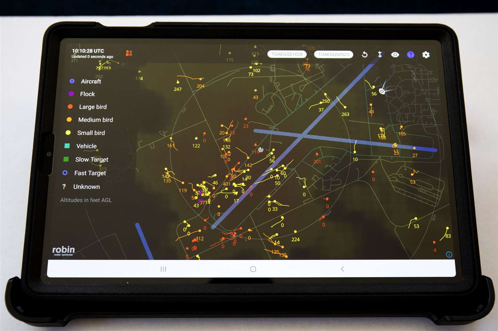
Project WINCHELL is a 12-month trial that uses an advanced 3D bird detection system to map avian activity around the airfield.
The system is now fully operational after the team assigned the task had less than six months to deliver it – one of the most rapidly delivered projects that the base has ever seen.
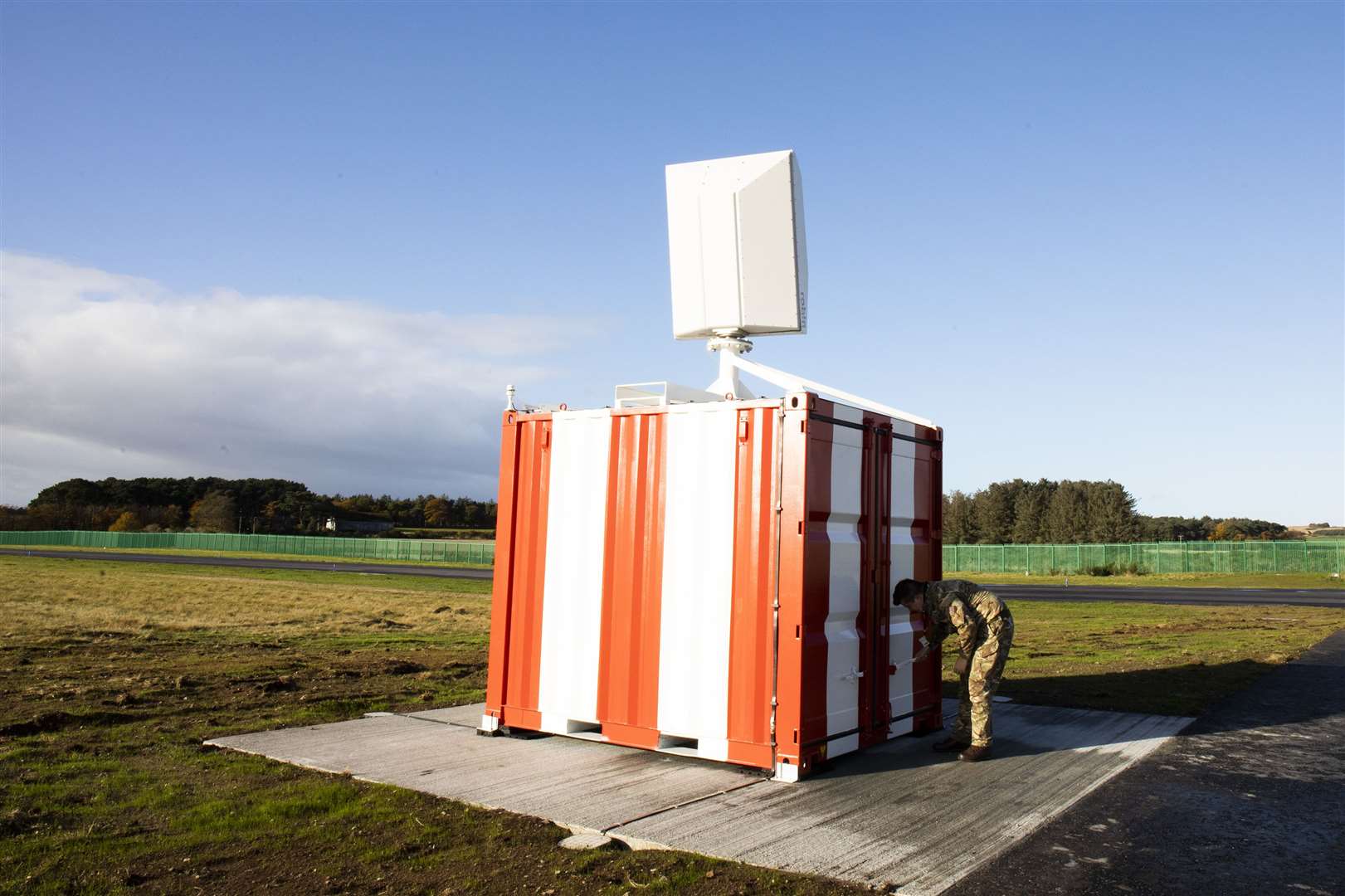
The off-the-shelf ROBIN 3D MAX avian radar was selected for the trial due to its versatility and because it operated on a safe frequency for the airfield.
The radar provides real-time height and positional information of airborne targets in 360 degrees. It accurately tracks bird activity out to 10km and up to a height of 700m.
Lossiemouth project manager Sqn Ldr Timms said: "RAF Lossiemouth has a unique bird strike risk due to being a coastal airfield surrounded by farmland containing a large number of pig farms.
"There are high numbers of corvids and seagulls in the vicinity of the RAF base and every winter around 10,000 geese arrive in Findhorn Bay."
Sqn Ldr Pete Surtees, of the Poseidon crew, said: "I was extremely impressed with both how accurate it was and the fidelity. It seemed to accurately depict not only the number and size of the birds, but the height, location and direction of travel."
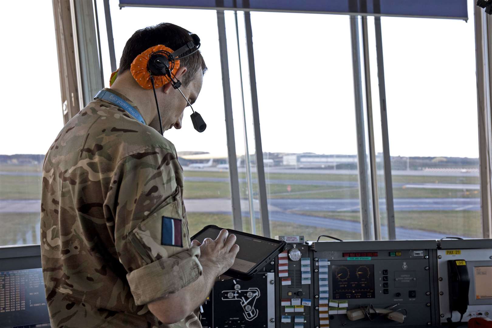
And Typhoon pilot Flt Lt Tim Looseley said: "The information the tablet provides is superb. The potential now exists to declare bird state levels based on real-time data and to use that to show trends. Overall, a great bit of kit which will have some great implications for the base."
Until now, flying activity at RAF Lossiemouth has been minimised during periods of peak bird activity to mitigate the risk of a bird strike.
The trial will also provide valuable research for other RAF stations in future.