


Moray Councillor Draeyk van der Horn calls on Moray Council and Ministry of Defence to take action on coastal erosion between Culbin and Burghead
Register for free to read more of the latest local news. It's easy and will only take a moment.

THE collapse of dunes in Findhorn has prompted a Moray councillor to raise the issue of increased coastal erosion with the Ministry of Defence (MoD).
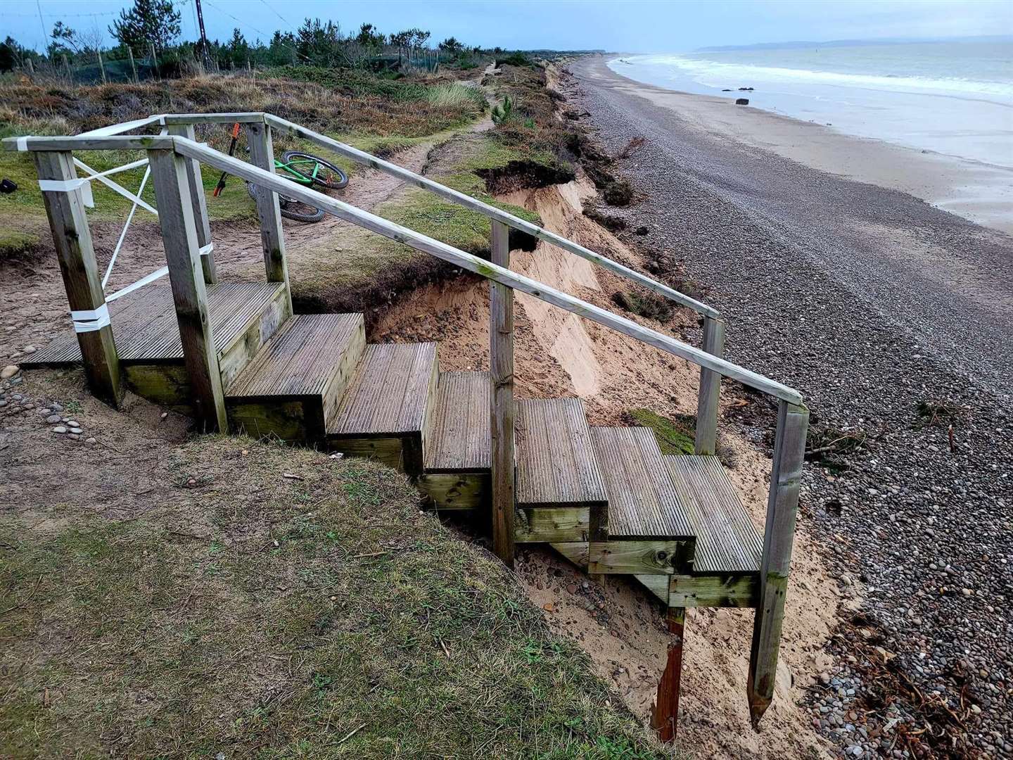
Cllr Draeyk van der Horn informed the local authority and 39 Engineer Regiment Barracks that the steps to the beach where the Kinloss perimeter fence meets Roseisle Wood have washed away with miles of pathway from Burghead along past Culbin.
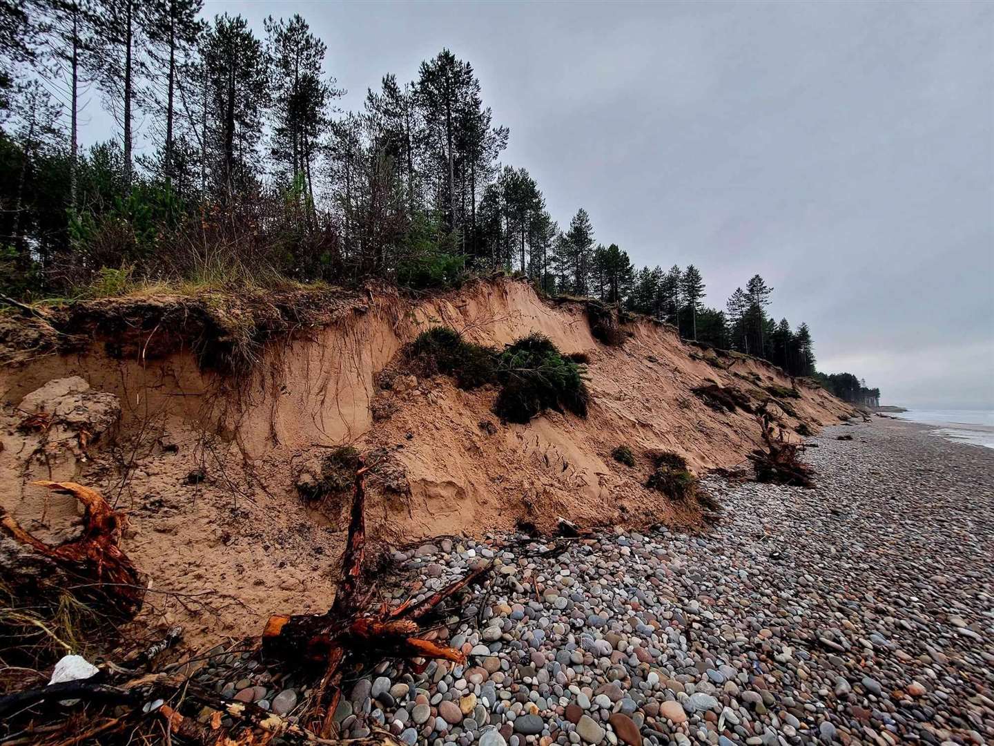
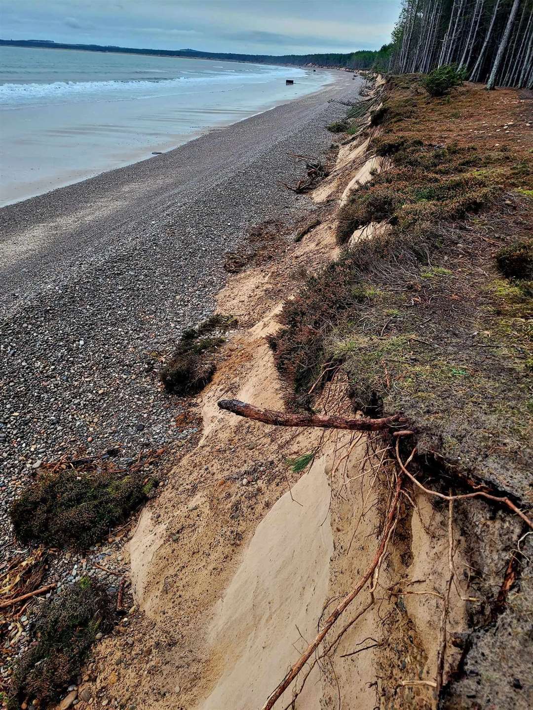
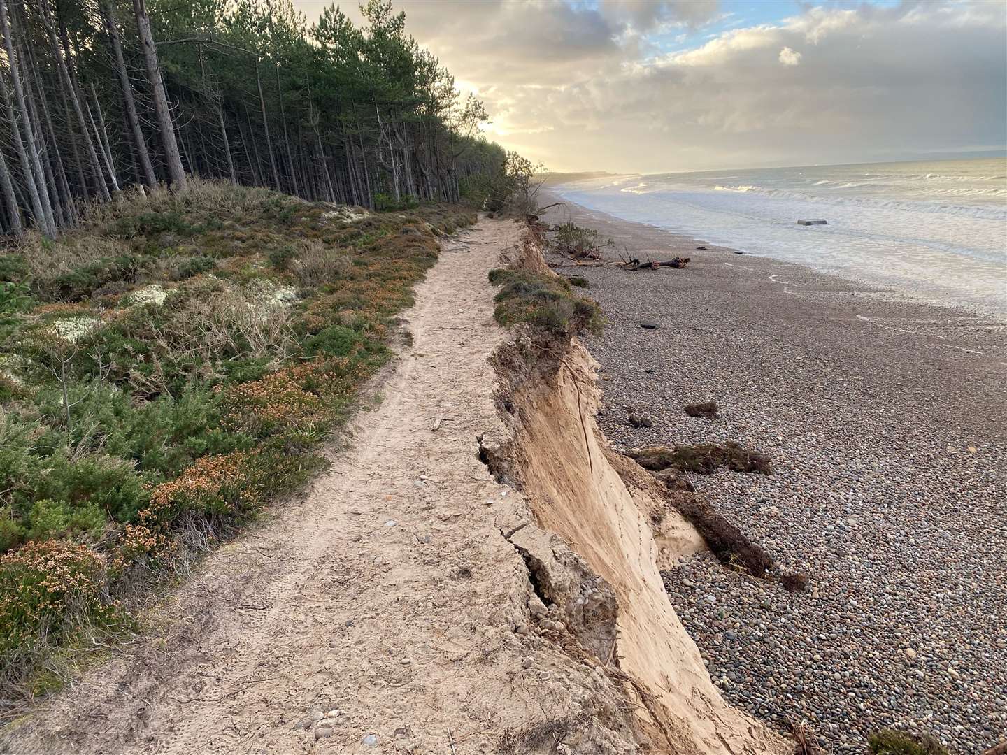
He said: “I first noticed on October 30 during my morning run. In some areas, 10 metres of sand, beach and dunes are washed away, exposing vertical cliffs.
“These new cliffs are up to 15 metres high with trees, shrubs and grasslands piled upon the beach. In some areas, dangerous overhangs are exposed, with footpaths running on the top in a state of near total collapse. These are unseen if on the path and yet could break up under foot, as I witnessed with a runner who narrowly missed falling on a crumbling path.”
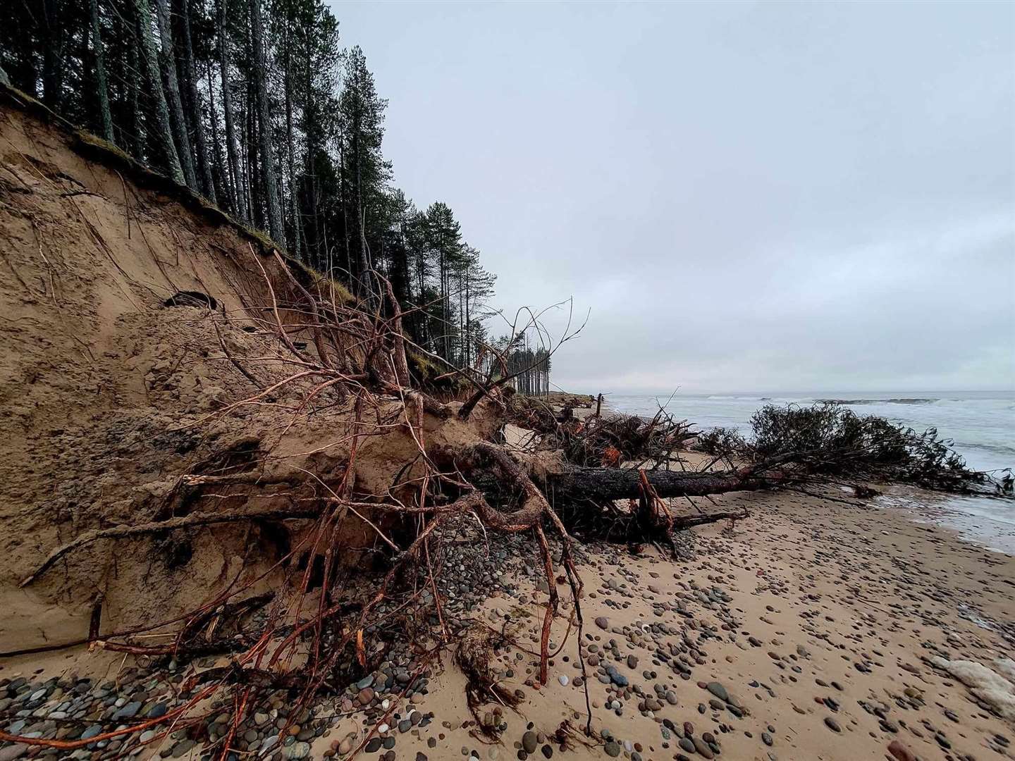
Cllr van der Horn points out that, over the last decade, Scotland has seen sea levels rise due to climate breakdown and unprecedented marine heatwaves. More frequent, stronger storms and high tides are a recipe for disaster.
“The combination is the worst in living memory of many residents I’ve spoken to,” he said. “The loss of the dunes is the canary in the cage for the loss of farmland and homes in the near future.
“We need to protect vulnerable properties, infrastructure and land. We can’t protect everything or afford expensive flood defences, but there are great examples of natural flood defence schemes, meaning surrendering more land to the sea but protecting the hinterlands.”
Ultimately, Cllr Van der Horn is calling for everyone to reduce our carbon footprint.
He said: “We must support the council’s route map to net zero by 2030 as well as all measures to reduce pollution and embrace approaches that build resilience, support biodiversity, and restore our climate. I call for a route map for the whole of Moray, and that we all pull together as a community in the face of the impacts of climate breakdown.”
Moray Council is the Coastal Protection Authority for the area and has discretionary powers to undertake works to protect land along the coastline. The local authority monitors the rate of erosion and assesses the need for intervention. It is currently developing Coastal Change Adaptation Plans in consultation with stakeholders, including coastal communities.
Expected to be finalised in the spring, the plans will identify influencing factors that define the direction and requirement for adaptation.
A council spokesperson said: “Influencing factors such as hazards, climate change, demographics, development potential, and economic opportunities will be monitored. Changes will be assessed to see if they meet pre-defined triggers that will activate either direct or indirect actions in response to these triggers. When triggers are reached, stakeholders, including the coastal community affected, will be consulted on the possible actions that may be taken to manage coastal change.”
Cllr van der Horn would like to know what the triggers are and it will take to elicit a response.
He said: "I is vital that we not only plan but act now. For example, I discussed with the MoD the potential need for a new vehicle route to the Findhorn peninsular because if we assume SEPAs somewhat conservative mapping is true then we could see the existing road from Kinloss lost to the bay within 20 years."
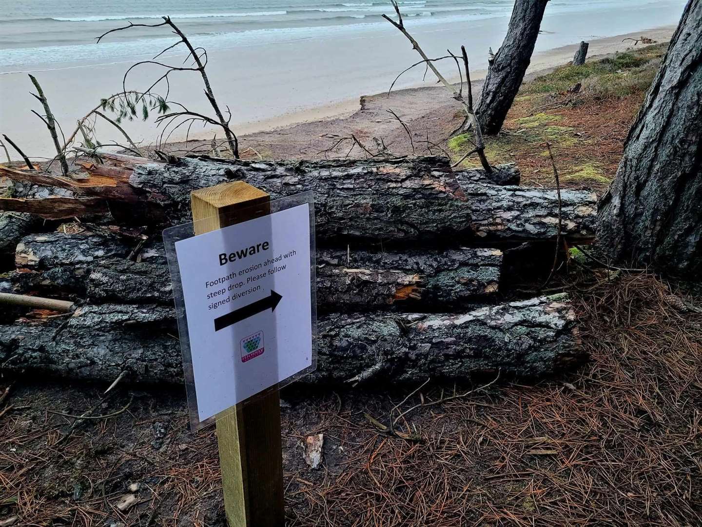
Meanwhile, warning signs have been put up between the MoD perimeter fence at Findhorn beach and Roseisle Wood.
An MoD spokesperson said: “The MoD was notified about the partial loss of steps installed a few years ago by 39 Engineer Regiment as a trade training project. The fence does not appear to have been damaged and the potential replacement of the steps is currently being considered.”
Cllr van der Horn added: “They hope to rebuild steps in the spring and discussions are ongoing to bring in the fence boundary, last done 20 years ago.
“Although the fence is intact, it’s now only two metres away from the cliff with what’s left of the coastal path within that strip. With so-called 1:200 storm surge events happening almost every few years, it’s hard to imagine we can wait too long for action.”
I would like to know what these so called “triggers” are and what exactly will it take to elicit a response, I have to ask are we in danger of not being prepared? It is fundamentally apparent to us all that we need to take a long view, but it is vital we not only plan but act now. For example, I discussed with the MOD the potential need for a new vehicle route to the Findhorn peninsular because if we assume SEPAs somewhat conservative mapping is true then we could see the existing road from Kinloss lost to the bay within twenty years.